
A day off for me rarely means “relaxation” in the traditional sense. Even if I plan to stick around the house, I will often make a snap decision on the day to take a quick drive somewhere…and that usually turns into an all-day excursion. Considering my current working schedule is 2:00 PM to 11:00 PM, I’ve started getting up later in the morning…but when I have a day trip planned, I get up early without struggle. Which is what happened yesterday!

After a two-and-a-half hour drive south through some hefty thunderstorms (almost had to pull over, it was raining so hard) I arrived at the only planned destination of the day: the Choctaw Nation Capitol. This marks the final Native American capitol building in Oklahoma for me, and the one that I have the strongest connection to. I have a mix of Native American heritage, which includes Cherokee and Havasupi, but I have more Choctaw blood than any other tribe. My mother estimates I am approximately 1/32 Choctaw, but it’s impossible to prove due to faulty record keeping. Out of all of the Native American Capitols in Oklahoma, the Choctaw building and grounds are the most robust. Thankfully, the sun came out just as I arrived so I could appreciate it all.
 There’s a mock village, a beautiful garden, war memorials, and plaques that talk about several aspects of Choctaw life. The Capitol building itself is still a functioning courthouse as well as a gift shop and museum. I was surprised to learn that the Choctaw were among the first ‘code talkers’ used by the U.S. Military in World War I, paving the way for the more famous Navajo talkers in WWII. I talked to one of the ladies working in the gift shop and was surprised to learn she had never been to any of the other Indian capitols. Maybe I take my travels around the state for granted, but that was still hard to fathom.
The capitol is also unique among the other tribes in that it’s not situated in the middle of a city center. Two miles south sits the town of Tuskahoma…and town is a generous term. The last census put the population at 151 and the only official town building I could find is a little red brick post office. Satisfied with my visit, I pulled up Google Maps on my phone. I make a habit of marking places for later, which comes in handy when I find myself in a far-off corner of the state with time on my hands. I selected the closest one and headed east. My next stop was a truss bridge in the town of Whitesboro, and it held special interest for me. I’d seen a few pictures of it online and it’s a peculiar one.
It appears to be a deck truss that’s been re-purposed as a through truss bridge. A through truss is what I seek out most often; that’s a metal bridge that you drive through. A deck truss is a bridge that looks like a normal concrete bridge on top, but has a network of metalwork beneath it. Here’s an example of a deck truss:

You can tell that the Whitesboro bridge is unusual right off the bat because of the way everything is attached. The corner joints are rough, not flat like the other bridges I’ve photographed. It’s also a bit narrower than usual, the piers it’s sitting on are the wrong size, and the road itself is arched; all of these details add up to the fact that the folks that put this bridge in place were either keen on saving money or conserving resources. In any case, it made for a fascinating stop for a bridge hunter like me.

 On to my next marked destination! As I continued east, I passed by a small roadside memorial for John F Kennedy. I drove by it in January when I was passing through the Ouachita Mountains, but didn’t stop. It’s a strange sight, sitting at the cross-roads of two rural highways in southeast Oklahoma. It turns out that 35th President of the United States came to the Sooner State to dedicate Highway US-259 on October 29, 1961. The memorial itself was built five years later. Most people sped by while I was admiring it, much like I did on my first visit. The grounds are well kept, shaded by a huge tree and in the shadow of the Ouachita Mountains. It was very peaceful, aside from occasional highway traffic. Several cars sped by as I stood and admired the memorial, much like I did my first time through.
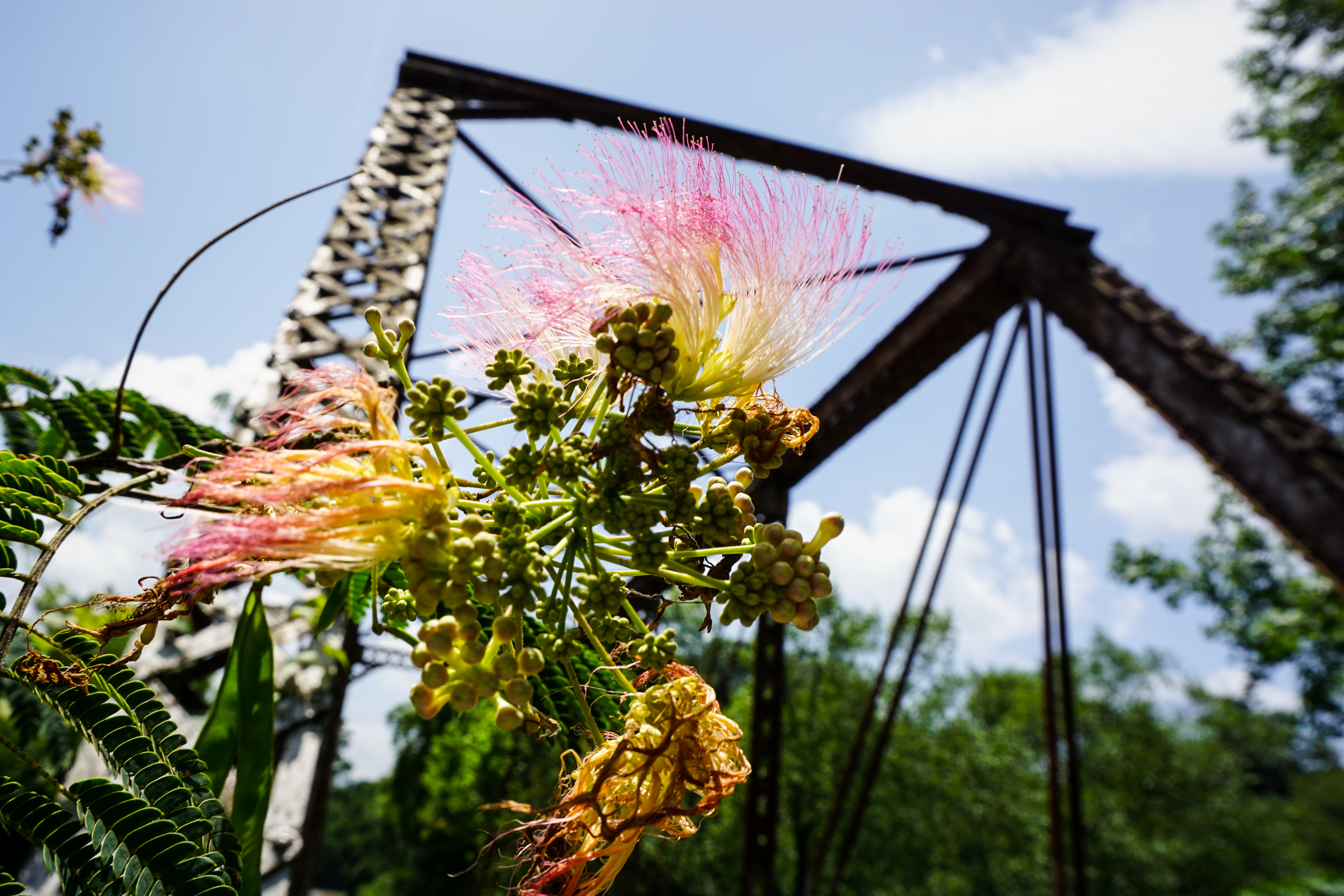 As I entered the Ouachita National Forest to the north of the memorial, my cell service began to suffer. My next destination was near the town of Haw Creek, which was situated near the Arkansas border in a very rural area. My map had stopped showing me individual roads (thanks to my attempt to re-route with one bar of service) and as I got closer I had to guess on which turns to take. Furthermore, Google Maps doesn’t support notes for marked locations, so I wasn’t entirely sure what I was looking for. I guessed it was a bridge, and I ended up being correct. It was also slightly irregular, as it’s very tall and extra narrow. Some online research suggests it may have started out as a railroad bridge somewhere else before being moved. It spans Big Creek, which was one of the clearest streams I’d seen in the state, and there were some beautiful flowers on the north side of the truss. I’m not sure what kind they are; they look like botanical fireworks!
 It was almost 1:00 PM, and I was starting to get hungry. There was a diner in nearby Heavener I was eager to try out, so I made that my next stop. I enjoyed a fine meal at the Southern Belle diner, which is a re-purposed passenger rail car! The inside has been beautifully decorated and the staff was super friendly. There are old photographs and artifacts of the train line that the car originated from decorating the walls, and I took a few minutes to peruse them after I’d finished eating. Happily full, I continued north to my final stop: an old railroad bridge in Marble City.
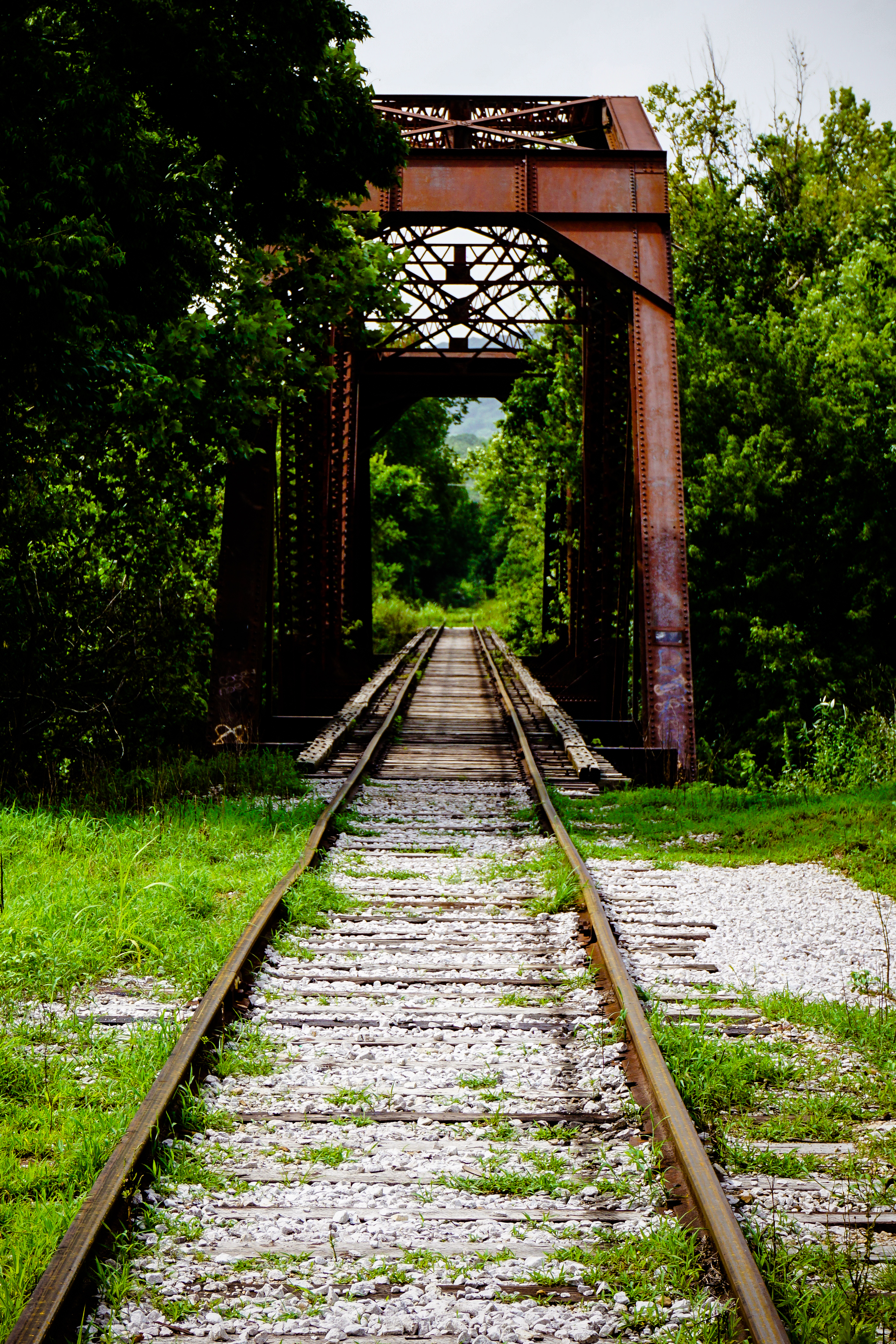
The entrance to the town was marked by a beautiful marble marker, which is appropriate considering the nearby marble quarry that the town is named after. The town itself didn’t have a lot going on, but the bridge was beautiful. It’s not terribly overgrown, as it hasn’t been out of use for long, and easy to access from the road. I didn’t venture out on it, though, as I kept thinking about the scene in Stand By Me. I didn’t care that it was abandoned, it still felt real!
As I started to drive home, the partly cloudy skies returned to a darkened state. They were beautiful and threatening as I approached Lake Tenkiller. My phone beeped in its cradle, and I glanced over to see an alert about a tornado warning in Cherokee County. I was in Cherokee County! I switched from my iPod to the radio for the weather and was relieved to hear I wasn’t near the circulation, but I ran into a heck of a rain storm. I got home just before 6:00 PM, having spent the equivalent of a work day on the road. It was anything but work, and as always just made me excited to plan the next one.

Enjoyable read about your adventures in Choctaw lands. Love the photos.
Thanks for an informative article. I was not aware that the Choctaw Nation had Code Talkers in WW I. I will be going to the 2015 Navajo Code Talker Days in Window Rock, Arizona. This ceremony is Friday August 14th. Approximately 17 of the elite 420+/- remain (information from Marine Corps League).