
Most of my free time lately has been going towards research and writing of my book on Lost Tulsa Restaurants — and I’m happy to say it’s going well! But all that time at the Tulsa Historical Society and other archives has taken away from my time on the road. Not to mention it’s been crazy cold around here! However, the forecast on Sunday was partly cloudy and near 70 degrees — so I opted to spend a day on the road.
More and more historic bridges are being replaced around Oklahoma. There were a few that I’ve had on my ‘To See’ list for a while that I knew I needed to visit soon, or else it would be too late. I headed west on I-44, past Oklahoma City, and then went south on Highway 81.
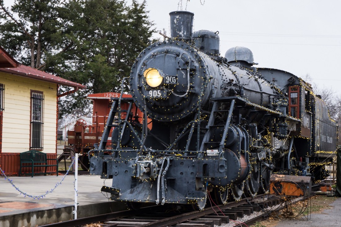
I diverted through a few small towns as I weaved towards the Red River: Rush Springs, Marlow, Duncan, Comanche, Waurika. Many great murals and most of the downtown districts had a bit of life in them, much to my surprise. Duncan has a Rock Island Railroad Depot Museum complete with locomotive, but winter hours meant it wasn’t open when I stopped by. Most of the diners and local stores that piqued my interest were closed on Sundays, too; I gotta remember to take these trips on Saturdays!
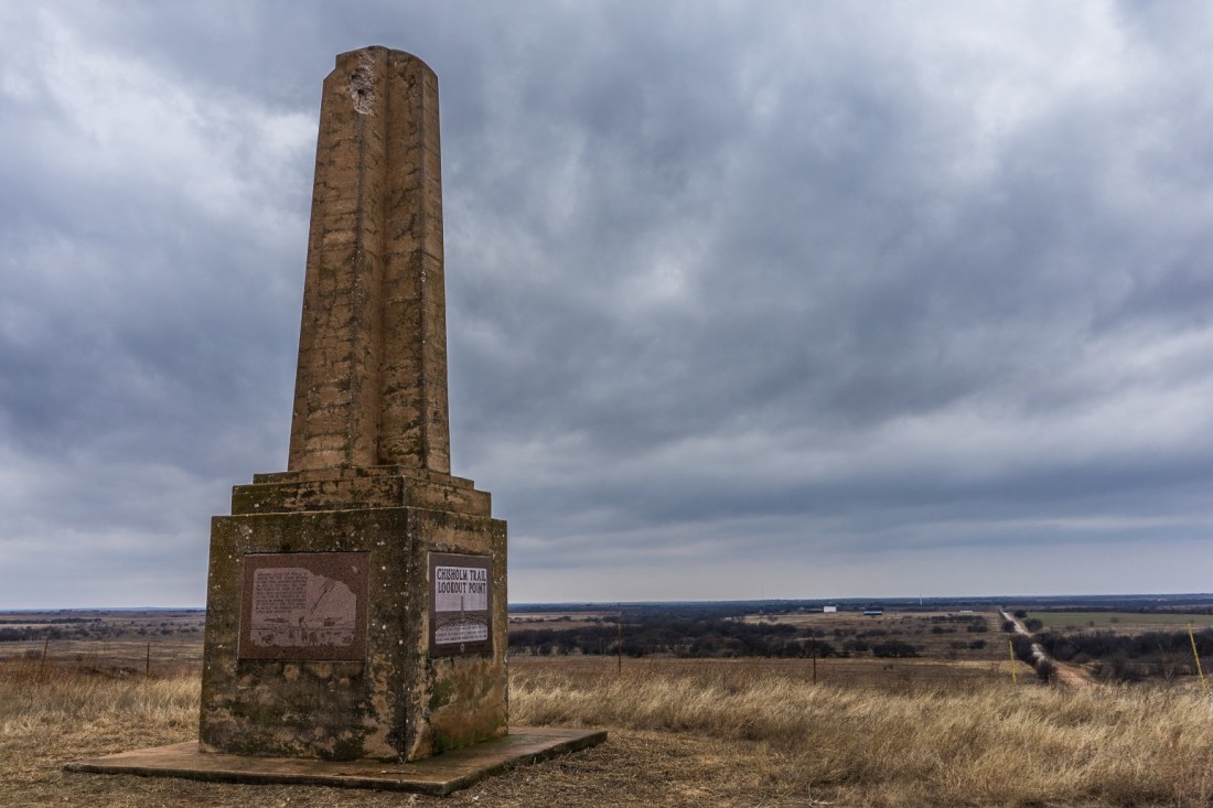
My first stop was at Chisholm Trail Lookout Point outside of Addington. An obelisk was constructed around Oklahoma’s centennial to mark the location on the historic cattle trail. It’s the highest point in Jefferson County and offers a view that was surely welcome to the cowboys driving their herds from Texas to Kansas.
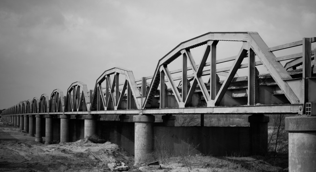
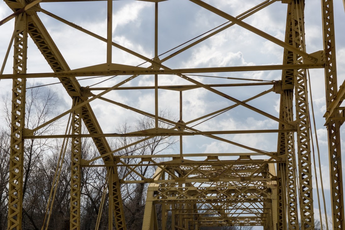
A few minutes later, I stopped at the spot that inspired the day’s journey: the endangered Red River Bridge on Highway 79. It connects Oklahoma and Texas with 21 camel-back pony trusses, clocking in at just over 2,200 feet. It’s on the National Historic Register and is the only bridge of its kind remaining on a Texas state highway. I hope that means it gets to stay around for pedestrian access, but, that is not guaranteed. Since the new crossing is already under construction, I was able to walk around a bit and get some good shots.
From the Texas border I drove east, once again meandering through a few small towns: Ringling, Wilson, Lone Grove. Ringling’s welcome sign looked like a circus tent even though the town didn’t appear to have any connection aside from name similarity. The clouds above me were darkening; I kept waiting for it to start raining but it didn’t.
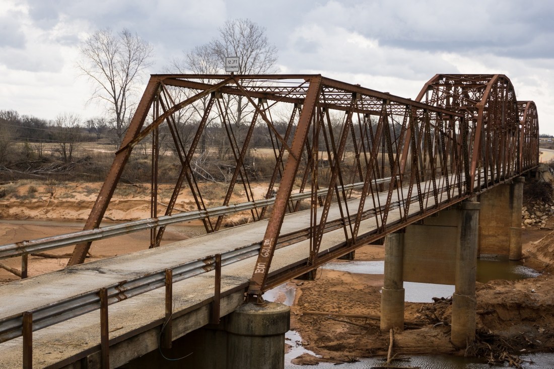
The next bridge I visited is also at the end of its days. The Greasy Bend Bridge over the Washita River is something of a Frankenstein; it’s three trusses long, with one being a totally different design than the other two, and the deck has had a number of band-aid repairs. Even though a few pickup trucks crossed while I was there, I didn’t feel comfortable driving over it. A new bridge is almost finished alongside; if I had waited a few weeks, I would’ve been too late. I doubt this old one will be left standing.
My next visit was to the Cumberland Cut Bridge near Fort Washita. This one was bypassed some time back; it’s actually in great shape. The yellow paint is still solid throughout & the street striping is still visible. I’ve driven across way worse bridges that are still in operation.

Clear Boggy Creek bridge in Caney, OK was a real treat. It’s on a gravel road lined with a canopy of tree branches; I’ll bet it looks amazing in the spring and summer. Furthermore, it’s right next to a railroad bridge. I’ll have to come back down and sit for a while. It looked like someone had done something similar on Saturday night; there was a smoldering campfire on the north end of the bridge on the side of the road.

I’d driven by the Dairy Lane Bridge south of Atoka dozens of times, but had never noticed it before. It’s a few blocks east of Highway 75 and passes over the Union Pacific Railroad track. No trains went by during my visit, but I enjoyed exploring the old single-lane crossing. It may have originally been built to serve a railroad itself, considering how tall it is.
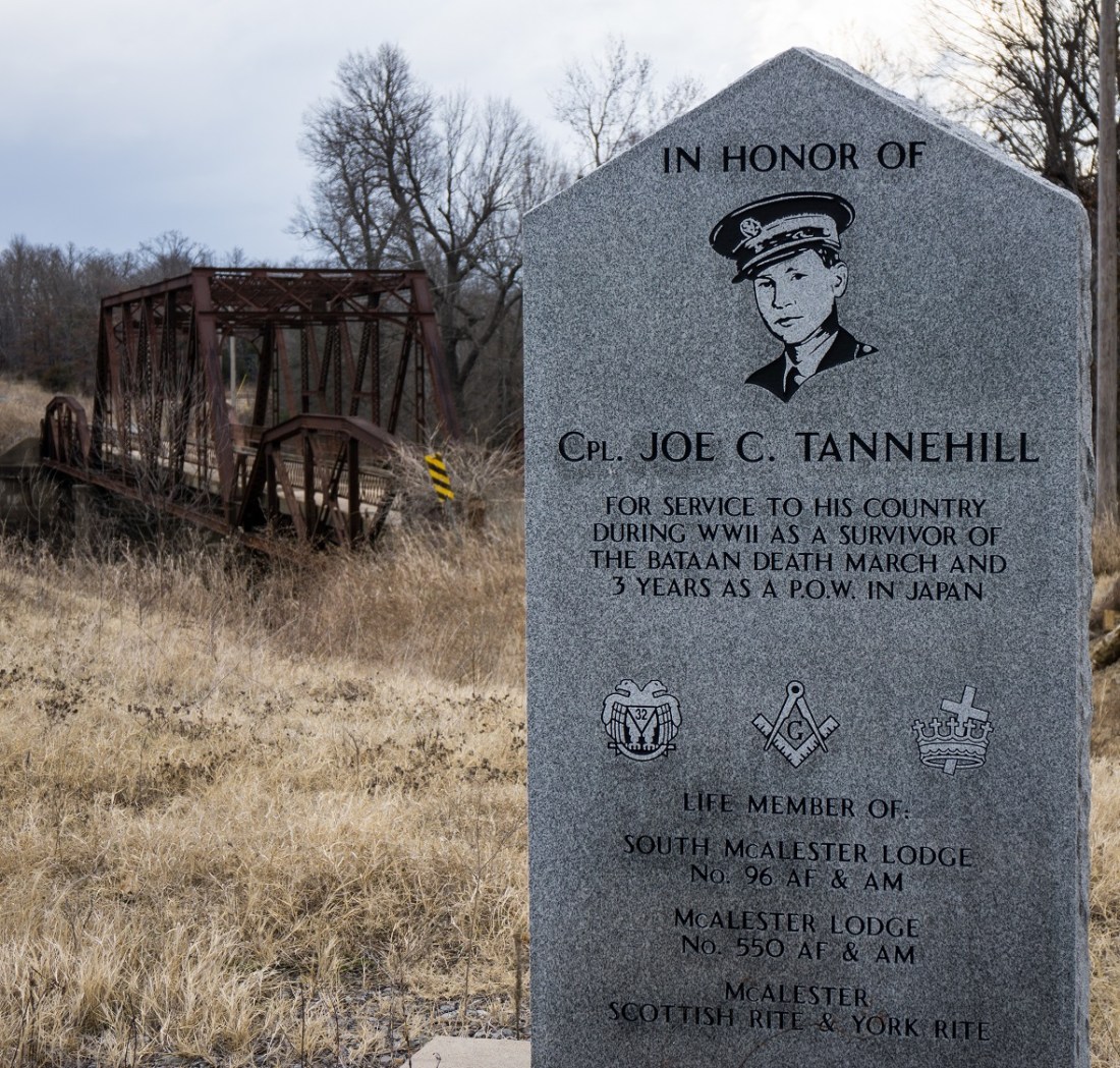
My last stop was northwest of McAlester on Tannehill Road. The Tannehill Bridge crosses Coal Creek and has been bypassed, but it was left standing probably due to its namesake. The bridge is dedicated to Cpl. Joe C Tannehill, a McAlester native and survivor of the Bataan Death March in World War II. There’s an excellent marker on the south bank of Coal Creek in his honor. The bridge is easily accessible for pedestrian use.
Less than five minutes after I returned to the car, the threatening clouds finally delivered. The sky had turned the dark grey/green that is normally associated with Oklahoma Springtime and the winds strengthened. Rain started suddenly and it was so dark I needed my headlights.
I scrambled down unmarked county roads, trying to find my way back to the Interstate. I hoped aloud that the narrow lane didn’t suddenly turn to dirt, as the last thing I wanted to do is get stuck out in the middle of nowhere. Thankfully, it remained paved, and soon I was back on the turnpike. I was even greeted with a vibrant rainbow as the sky cleared on the way home; a match to my bright spirits after a day of exploration.

Always a treat, Rhys. Thank you. Did you ever get to the Kiamichi river bridge, NE of Antlers?
No sir, that one has also been marked on my map for a while. I understand it was being replaced last summer, not sure if it is still there…